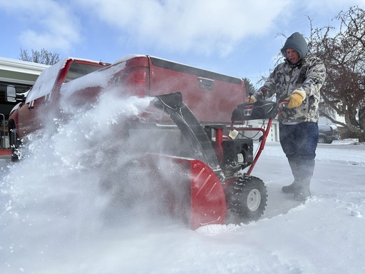
BISMARCK, N.D. — A rapidly advancing winter storm unleashed a mix of snow, ice, strong winds, and frigid temperatures across a significant portion of the upper Midwest. This weather event severely disrupted traffic in the Twin Cities and led North Dakota authorities to close an interstate highway due to hazardous conditions.
The National Weather Service has issued winter storm warnings for extensive areas across Minnesota, Wisconsin, and the Dakotas. Many interstates in these regions became snow-covered and perilous, leading to numerous minor accidents, including fender-benders and slide-offs, with some resulting in injuries. Fortunately, there were no immediate reports of fatalities.
In Minnesota, forecasts predicted snowfall accumulation of up to 7 inches (18 centimeters), affecting the Twin Cities, where morning commutes on Thursday came to a near standstill as the snow intensified. North Dakota experienced particularly harsh conditions, with wind gusts reaching up to 50 mph (80 kilometers per hour) Wednesday night into Thursday morning. Although snowfall totals mostly remained below 6 inches (15 centimeters)—not especially significant for North Dakota—these amounts were sufficient to render travel hazardous.
Freezing rain exacerbated the dangerous road conditions. As a result, the North Dakota Highway Patrol issued a “no travel advisory,” urging drivers to stay off the roads. However, this did not include large vehicles in the northwest region, where the patrol communicated via social media that “No Oversize loads in the Northwest Region until further notice.”
On Thursday morning, a 50-mile (80-kilometer) segment of Interstate 94 in North Dakota was temporarily closed for about 90 minutes after snow and ice rendered it nearly impassable, resulting in several trucks becoming immobilized. “This is a section of the Badlands that passes through the area, which features many hills,” explained highway patrol Sgt. Coby Hubble. “We observed commercial vehicles that were unable to traverse this area and ended up stuck.”
In parts of Wisconsin and Minnesota, snowfall ranging from 5 to 7 inches (13 to 18 centimeters) was anticipated. Additionally, forecasters in Minnesota warned of strong winds through the day, raising the possibility of whiteout conditions.
At Minneapolis-St. Paul International Airport, flight operations were temporarily halted due to the weather. At the early afternoon mark, the airport reported that 63 incoming flights and 89 departures faced delays.
Phil Helfrich, preparing for a trip to Denver to visit his grandchildren, was filling his tank in the windy and mostly empty streets of Bismarck. The challenging weather would not deter him, as he had equipped his vehicle with snow tires and packed a survival kit. “I’m looking forward to it, and my grandkids are too,” said Helfrich.
Interestingly, the snowfall comes after a relatively dry spell, as the Twin Cities had recorded less than 3 inches (8 centimeters) of snow before this week, a stark contrast to the typical accumulation of over a foot (30 centimeters) by mid-December.
It remains uncertain whether the snow will linger long enough for a white Christmas. Current forecasts suggest that much of the upper Midwest will experience a clear outlook over the holiday period, with temperatures expected to rise above freezing early next week.
