Meteorologists are issuing warnings for potentially lethal flash floods and powerful tornadoes as a sequence of thunderstorms is set to impact sections of the Midwest and South.
The Weather Prediction Center, part of the National Weather Service, has cautioned that the approaching storm system could result in “significant, life-threatening flash flooding” beginning Wednesday.
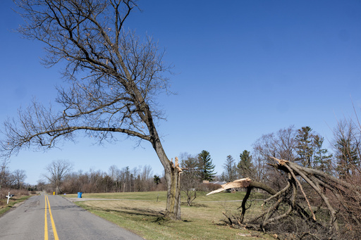
This alarming flood risk emerges just as people in parts of Michigan are still recovering from the aftermath of a weekend ice storm.
Anticipated rounds of heavy rain from thunderstorms are forecasted for Texas, the lower Mississippi Valley, and the Ohio Valley starting midweek and persisting through Saturday.
Experts warn that the storms might repeatedly hit the same regions, leading to sporadic heavy rains and treacherous flash floods capable of sweeping vehicles away.
Especially vulnerable are areas of Arkansas, western Tennessee, western Kentucky, and southern Indiana.
The forecast suggests that northeastern Arkansas, southeastern Missouri, western Kentucky, and southern areas of Illinois and Indiana may experience up to 15 inches (38 centimeters) of rain over the upcoming seven days.
The rainfall that eastern and northeastern Arkansas could see is generally expected just once every 25 to 50 years.
“We’re possibly facing around two months of rain compressed into just a few days,” said a meteorologist from the National Weather Service in Little Rock, Arkansas.
This extraordinary volume of rain is unusual, accentuated by moisture from the Gulf which is amplifying the precipitation that the thunderstorms could unleash.
On Tuesday, the Midwest could face powerful tornadoes.
Forecasts indicate that Oklahoma, Kansas, and Missouri may encounter tornado activity.
The National Weather Service’s Storm Prediction Center in Norman, Oklahoma, has predicted severe thunderstorms, including potentially several supercells, on Tuesday evening and into the night across central and southern Oklahoma, central Kansas, and western Missouri.
Key concerns include very large hail — at least 2 inches (5 centimeters) in diameter — in addition to a few tornadoes, some potentially robust, alongside severe wind gusts.
The regions of greatest concern for a significant tornado include Oklahoma City, Wichita, and Topeka.
The threat for large hail spans from Fort Worth, Texas, to Kansas City.
The severe weather risk elevates significantly on Wednesday, impacting an extensive area from northeast Texas to Michigan.
About 43 million people, including residents in major cities like Chicago, Indianapolis, St. Louis, and Memphis, Tennessee, are in the highest risk zone for severe weather.
Additional cities such as Dallas, Detroit, Milwaukee, and Nashville, Tennessee, are also susceptible to severe storms.
Impending rains are projected for the New Madrid Seismic Zone, an area actively monitored for earthquakes east of the Rocky Mountains.
This zone is centered in southeast Missouri, extending to neighboring states like Arkansas and Tennessee, and is historically known for significant earthquakes in the early 19th century.
Experts remain cautious of the possibility of another major quake occurring here.
Mitch Withers, a research professor at the Center for Earthquake Research and Information, emphasized the importance of strategically positioning monitoring equipment to ensure data collection during floods, underlining that around 70 stations should remain unaffected by the rising waters.
Meanwhile, the Upper Midwest is facing its own weather challenges.
Following a weekend ice storm, crews in Michigan are working to restore power.
According to PowerOutage.us, nearly 200,000 outages were reported in Michigan with an additional 25,000 in Wisconsin.
The ice storm has already led to school closures in various counties for a second consecutive day.
Authorities are busy clearing blocked roads, while residents experience long queues at fuel stations.
Looking ahead, further wintry conditions are expected to impact the region.
Sleet and freezing rain may create hazardous driving conditions into Wednesday across parts of Michigan and Wisconsin.
In addition, the eastern sections of the Dakotas and parts of Minnesota are forecast to receive heavy, wet snow from Tuesday night into Wednesday.


