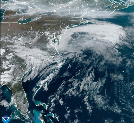
A powerful weather system is expected to impact over 100 million Americans starting Friday, posing threats of wildfires, blizzards, tornadoes, and floods as it makes its way eastward over the Great Plains. While the potential scope and intensity of the storm are noteworthy, its occurrence during this time of year is not unexpected. Spring is a period where large temperature variations between the warming southern areas and the still-cool northern regions can lead to severe weather.
Meteorologist Benjamin Reppert from Penn State University noted the capability of this season to produce widespread storms affecting coast-to-coast regions. On Friday, the National Weather Service predicts strong winds from the Canadian border down to the Rio Grande, with gusts possibly reaching 80 mph (130 kph). Such conditions heighten the risk of wildfires across Texas, New Mexico, and Oklahoma. Simultaneously, a winter storm is anticipated to strike further north, affecting areas in the Rockies and Northern Plains, potentially creating blizzard conditions in parts of the Dakotas and Minnesota.
Regions stretching from the Gulf Coast to Wisconsin may face severe thunderstorms, with threats of developing tornadoes and hail. Moving into Saturday, these harsh conditions are expected to progress toward Louisiana, Mississippi, Alabama, Tennessee, eventually reaching Florida. Concerns over flooding are prominent from the Central Gulf Coast to the upper Ohio Valley.
As the storm approaches the East Coast by Sunday, strong winds and localized flash flooding are expected. Significant rainfall is forecasted along the Interstate 95 corridor down to Jacksonville, Florida. Reppert emphasized that the upper atmosphere temperatures in much of the central and eastern U.S. are near record highs for this season. Meanwhile, cooler air behind the storm in the western states is among the coldest recorded for this time, which may contribute to the storm’s vigor.
Russ Schumacher, a climatologist from Colorado State University, commented on the possibility of the storm evolving into a bomb cyclone by Friday afternoon or evening. This term describes a storm that rapidly intensifies with a drastic drop in atmospheric pressure over 24 hours, leading to stronger winds and increased rainfall.
The storm’s development is bolstered by the jet stream, which is currently stretching southward across the United States, aiding in lifting air and moisture to generate rain. Additionally, warm moisture from the Gulf of Mexico, which is notably warmer than average, is expected to feed the storm further.
Ryan Torn, a professor at the University at Albany, likened the current atmospheric conditions to a “Goldilocks situation,” implying that the perfect mix of ingredients is present to fuel the storm’s power.


