California is experiencing rainfall as an atmospheric river approaches, expected to deliver intense downpours, strong winds, and potential flooding to areas recently impacted by wildfires. In anticipation of the storm, local authorities have distributed sandbags and positioned rescue teams while advising residents to prepare their emergency go-bags.
In contrast, Portland has treated its roads with 2,000 gallons of anti-icer as officials in Oregon and Idaho set up emergency shelters to brace for a challenging mix of snow and ice expected to start Thursday.
Southern California faces the possibility of up to 6 inches (around 15 centimeters) of rain in mountainous regions and 3 inches (approximately 7.6 centimeters) in coastal and valley areas, according to hydrologist Brent Bower of the National Weather Service. The region is also likely to experience strong winds that could result in downed trees, power outages, and disruptions to flight schedules.
Evacuation alerts have been issued for Mandeville Canyon and other regions affected by the Palisades Fire, the most devastating fire recorded in Los Angeles city history, due to concerns regarding imminent debris flows from the storm. Warnings have similarly been issued for Trabuco Canyon and other localities near the burn scars from the Airport Fire.
As a precaution, all schools in Malibu were closed on Thursday, and the Knott’s Berry Farm amusement park also shut its doors due to the incoming atmospheric river—a substantial plume of water vapor capable of transporting moisture from tropical regions into northern areas.
Daniel Swain, a climate scientist at the University of California Agriculture and Natural Resources, indicated that while the region is in dire need of precipitation, the impending rain might arrive too forcefully. This situation raises concerns about potential debris flows and flash flooding, particularly around areas scarred by wildfires.
The vulnerability of these burned landscapes to debris flows stems from the loss of vegetation that typically anchors soil in place, compounding risks from loose debris, including ash, soil, and rocks, as noted by Swain in his remarks.
County officials have warned of potential road closures and have advised residents to stay alert for any mandatory evacuation orders that may be issued.
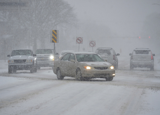
In the eastern U.S., the rains follow storms from Wednesday that blanketed areas from Kentucky to Washington D.C. with heavy snow and freezing rain, leading to numerous traffic accidents, power outages, and threats of flooding in certain regions.
This weather system, which impacted states from Kentucky to Maryland and beyond, resulted in over 14 inches (37 centimeters) of snow in a small town in western Virginia, and 12 inches (30.5 centimeters) in another town nearby, as reported by the National Weather Service.
As of early Thursday, more than 150,000 customers in Virginia and over 13,000 in North Carolina were without electricity, according to data. Appalachian Power, serving customers across Virginia, West Virginia, and Tennessee, indicated that over 5,700 workers were deployed for restoration efforts.
Airports throughout the region received several inches of snow, according to meteorologist Scott Kleebauer from the Weather Prediction Center. Travel disruptions were significant, with nearly 7,000 flights canceled or delayed across the U.S. on Wednesday, including around 300 at Ronald Reagan National Airport in the D.C. area.
Traffic accidents were rampant; in Kentucky, snowy conditions led to a deadly crash in Nelson County, while Virginia reported around 850 accidents over two days, with numerous injuries involved. The state of emergency was declared by Gov. Glenn Youngkin.
In Maryland, state police reported 235 vehicle crashes, including many abandoned vehicles. Multiple major highways in southern West Virginia were also temporarily shut down due to road conditions.
In the Pacific Northwest, freezing rain and snow are anticipated in northwest Oregon and southwest Washington, which could lead to further power outages, as warned by the National Weather Service.
Officials in Multnomah County, Oregon, extended a state of emergency through at least Thursday, opening six emergency shelters that had seen 356 occupants by Tuesday night. Wind chill factors in Portland could plummet to 10 degrees Fahrenheit (minus 12 Celsius).
In Idaho, a cold weather advisory is in effect, with wind chills potentially reaching as low as minus 13 degrees Fahrenheit (minus 25 degrees Celsius) in the state’s north-central region.
An ice storm predicted to hit Portland early Thursday and Friday poses challenges for local flower deliveries and other Valentine’s Day gifts. Temperatures took a drastic drop earlier in the week in the typically rain-heavy Portland area.
Julia Duncan, co-owner of Flowers in Flight, remains optimistic, recalling previous winters with similar ice storm challenges while noting that customers tend to go the extra mile for their loved ones. “It’s Valentine’s Day!” she remarked, indicating a hopeful outlook despite the weather.
With local drivers willing to brave the icy conditions for deliveries, Duncan expressed confidence that the store’s operations would be minimally affected. “We have a couple of drivers who are willing to drive in the ice and snow,” she added, emphasizing community resilience.


