

New Yorkers should brace themselves. This weekend brings more than just a weather shift—it brings whiplash. After Saturday’s nearly record-breaking warmth, a brutal storm system is on the way. It’s part of a growing extreme weather outbreak spreading across the country.
From Sunshine to Severe Storms in 48 Hours
Saturday’s high could hit 83 degrees. That’s just below the record of 86 set in 1998. Many will head outside to enjoy the warmth. However, the calm won’t last.
By Sunday night, temperatures are set to plunge by more than 30 degrees. Forecasters predict strong wind gusts up to 60 mph. Severe thunderstorms are also likely, and tornadoes can’t be ruled out. This dramatic change won’t just affect New York—it’s part of a broader extreme weather event.
Storms Hit Central U.S. First
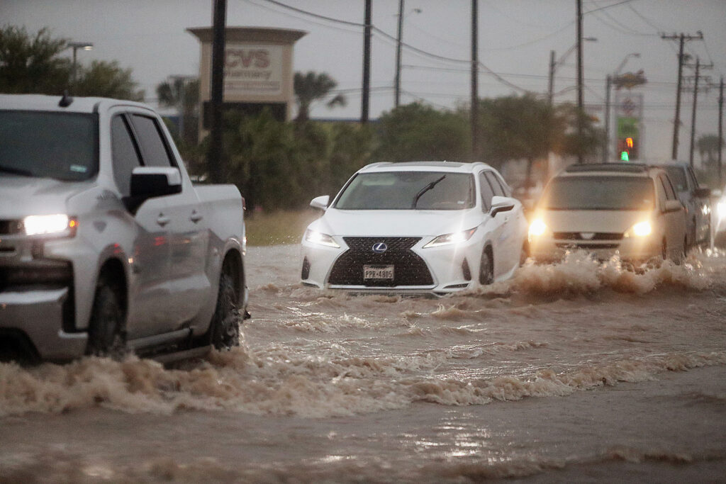
The trouble starts farther west. On Sunday, dangerous storms will move from Texas to Michigan. Meteorologists expect the worst weather in the Ohio and Tennessee Valleys. These areas could see massive hail, destructive winds, and even strong tornadoes.
By Monday, the storm front will reach the East Coast. Cities like Philadelphia, Baltimore, and New York will likely see violent weather conditions.
Cold Front Creates Perfect Storm Setup
The chaos stems from a powerful cold front moving through the Great Lakes. At the same time, warm, moist air rises from the South. When these air masses collide, they spark explosive storm systems.
Marc Chenard from the Weather Prediction Center explained it clearly. “Warm air and moisture in the South will fuel thunderstorms. Some of those storms will turn severe.”
Saturday Night Brings Trouble to the Midwest
Even while New Yorkers enjoy summer-like sun, severe weather will already be underway elsewhere. Saturday night, storms will strike parts of Oklahoma, Kansas, and Missouri. Forecasters expect large hail and dangerous wind gusts.
By Sunday, these conditions will become more widespread. More states will face damaging storms as the system pushes eastward.
Extreme Weather: Temperatures to Plunge in NYC
The temperature shift in New York will feel dramatic. After a warm Saturday, Sunday could drop into the low 50s. Cody Braud from Fox Weather warned that it’s a sharp swing. “That kind of drop doesn’t sit well with people,” he said. “If you’re out and about, it’ll hit you hard.”
Many residents might not dress for the chill. The warmth of Saturday could make Sunday feel colder than it is.
Monday Brings the Worst to the Northeast
On Monday, the storm system will strike the Northeast with full force. Winds may down trees. Torrential rain could flood roads. And isolated tornadoes are still possible. Officials urge people to stay alert and plan ahead.
With spring underway, many expected mild weather. Instead, extreme weather continues to disrupt routines and threaten safety.
Storms, Heat, Fire—A Volatile Season Begins with Weather Extrems
This weekend’s storms aren’t happening in isolation. Wildfires are tearing through parts of the Carolinas. Hurricane forecasts already suggest a busy season ahead. And volcanic activity in Hawaii adds more uncertainty.
The nation now faces overlapping threats—from heat waves to tornadoes to flooding. As spring turns into summer, extreme weather events appear to be growing stronger and more frequent.
Experts warn that conditions will remain unstable in the coming weeks. New Yorkers and others across the East Coast should stay prepared.