Storms resulting in a brief tornado and subsequent flash flooding affected parts of West Virginia and Kentucky on Thursday, causing rivers to overflow. Several states were coated in a wintry mix that included layers of ice and the phenomenon referred to as “thunder ice.”
Flash flooding was particularly notable, with residents and storm observers in regions such as Indiana, southern Michigan, Ohio, and Pennsylvania witnessing a peculiar mix of freezing rain accompanied by intermittent lightning. One Ohio resident, Brian Heffner from Spencerville, shared his astonishment over the strange weather on social media, saying he had never experienced thunder and lightning during an ice storm before.
Through the night, a long series of thunderstorms persisted, leading to heavy rainfall that flooded numerous neighborhoods. This not only triggered mudslides and rockslides but also caused hazardous conditions on the roads, prompting several accidents on interstate highways. Many schools across various counties either delayed their start times or closed altogether on Thursday as a precaution.
In West Virginia, numerous motorists needed assistance after becoming stranded in rapidly rising floodwaters. Additionally, the Kanawha-Charleston Humane Association made an appeal to the public for assistance in adopting or fostering 15 dogs, as part of their shelter was threatened by flooding.
In Charleston, the rain accumulated to several inches, leading local officials to activate an emergency operations center. In Huntington, situated along the Ohio River, residents were advised to stay indoors for a few hours as the flooding risk heightened, although this advisory was lifted by Thursday afternoon. By the evening, flood warnings remained in effect across much of West Virginia, as well as portions of eastern Kentucky and southeastern Ohio.
Meanwhile, in south-central Kentucky, the National Weather Service confirmed the occurrence of a brief EF1 tornado with winds reaching 95 mph, damaging roofs and scattering debris in Hart County, located about an hour south of Louisville. Thankfully, no injuries were reported immediately following that event.
Additionally, some mid-Atlantic states were left with a layer of ice on roads and trees before a rise in temperatures later in the day. Despite the ice accumulation, most areas managed to avoid extensive power outages, a common consequence of such severe weather.
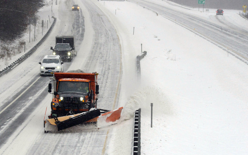
Forecasts indicating several inches of snow led to school delays and closures throughout New England. In Maine, over 200 educational institutions and businesses opted to close or diminish operations early due to the inclement weather. One particular district, the Kennebunk area school district, decided to close for the day entirely, prioritizing safety over what could have been a messy commute for school buses during the afternoon hours.
Superintendent Terri Cooper commented on the situation, emphasizing concerns over rapidly deteriorating road conditions and the potential risks they posed for students and staff during an early release scenario.


