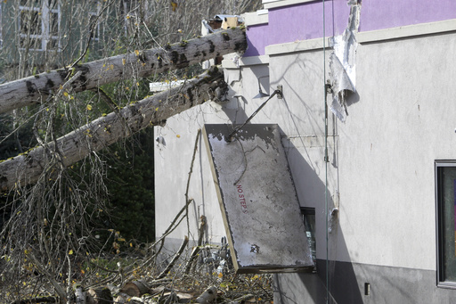
SANTA ROSA, Calif. — A significant storm swept through Northern California on Wednesday night, bringing heavy rain and snowfall which posed threats of flash flooding and rockslides across the region. This latest weather system is part of a series of impactful storms affecting the West Coast.
The National Weather Service has issued a flood watch for areas north of San Francisco, which will remain in effect until Saturday. This storm is characterized as the strongest atmospheric river recorded this season, delivering an abundance of moisture that has saturated the region. Just the night before, the storm’s powerful winds resulted in two fatalities and left hundreds of thousands without electricity in Washington state.
Forecasts indicate that Northern California and southwestern Oregon could receive up to 16 inches (approximately 41 centimeters) of rain by Friday, with certain areas in Northern California already reporting around 5 inches (about 13 centimeters) within a 24-hour period, as noted by meteorologist Marc Chenard.
Officials have raised alarms about the potential for dangerous flash flooding, rockslides, and debris flows. In the past day alone, several small landslides appeared in northern California, including one on Highway 281 that led to a vehicle collision on Wednesday morning.
The Bay Area National Weather Service warned residents that the center of the atmospheric river is currently affecting the North Bay, advising them to prepare for continued heavy rainfall into Thursday and Friday, which will likely result in mudslides and road closures.
This storm, classified as a “bomb cyclone,” intensified rapidly, starting its impact on Tuesday. There is also a winter storm watch activated for elevations above 3,500 feet (about 1,066 meters) in the northern Sierra Nevada, predicting up to 15 inches (38 centimeters) of snow over the next two days. Forecasters anticipate wind gusts could exceed 75 mph (121 kph) in mountainous regions.
By Wednesday evening, the storm had already dumped over a foot of snow across the Cascades, producing blizzard conditions and rendering travel highly dangerous in certain areas.
In Washington state, nearly 376,000 power outages were reported as of Wednesday evening, with the severe weather attributed to the high winds and rain from the previous night. Tragically, at least two individuals lost their lives due to falling trees; one incident involved a tree collapsing on a homeless encampment in Lynnwood, while another took place in Bellevue where a tree fell onto a residence.
The severe weather resulted in the closure of more than a dozen schools in the Seattle vicinity, with some opting to extend these closures through Thursday.
In California, reports indicated around 21,000 power outages as of Wednesday evening. The Oregon Department of Transportation announced a closure of a section of southbound Interstate 5 extending 11 miles (about 18 kilometers) from Ashland, Oregon, to the California border because of prevailing winter conditions. This closure is expected to last for an extended period.
Travel disruptions continued as hundreds of flights at San Francisco International Airport faced delays, with several cancellations reported according to Flight Aware.
The National Weather Service has also placed parts of southwestern Oregon under a flood watch through Friday evening. Concurrently, rough weather conditions prompted a temporary halt to a ferry service in northwestern Washington between Port Townsend and Coupeville.
