Rain has started to pour across California as an atmospheric river is set to unleash heavy rainfall, strong winds, and potential flooding in areas previously scorched by wildfires on Thursday. In preparation for the storm, authorities have been proactive in distributing sandbags, positioning rescue swimmers, and urging residents to prepare go-bags for emergencies.
In Portland, Oregon, city officials treated roadways with liquid anti-icer, while emergency shelters were opened across the state and into Idaho in anticipation of upcoming snow and ice on Thursday.
Southern California could experience up to 6 inches of rain in mountainous regions and around 3 inches in coastal areas and valleys, as reported by Brent Bower, a hydrologist with the National Weather Service. The consequent strong wind gusts pose risks of downed trees, power interruptions, and flight delays.
Evacuation alerts were issued for Mandeville Canyon and other regions affected by the devastating Palisades Fire, which is noted as the most destructive fire in Los Angeles history. Similar warnings have been extended for Trabuco Canyon and locations near previous wildfire burn scars due to the increased risk of debris flows during the storm.
As a precaution, all schools in Malibu closed on Thursday, while the Knott’s Berry Farm amusement park suspended operations due to the impact of the atmospheric river. This phenomenon consists of a lengthy band of water vapor originating over the ocean, transporting moisture from tropical regions to the northern latitudes.
Daniel Swain, a climate scientist from the University of California Agriculture and Natural Resources, remarked that the region is in dire need of rain; however, this storm may arrive too swiftly, potentially leading to hazardous debris flows and flash flooding in areas previously affected by wildfires. These burn locations are particularly vulnerable to debris flows because the vegetation that stabilizes the soil has been destroyed, leaving loose materials like ash and rocks susceptible to being washed away.
In the Eastern United States, schools across New England faced cancellations or delays owing to heavy snow and icy conditions creating treacherous driving circumstances. Many districts had experienced similar weather-related closures recently, and another snowstorm is on track for this upcoming weekend.
Maine’s roadways were slick with snow and ice early on Thursday, with a few inches recorded in the northern areas of the state. The Kennebunk district, located along Southern Maine’s coast, chose to cancel classes as a safety measure.
“Snow is expected during morning commute hours, with possible icing conditions to follow,” stated district superintendent Terri Cooper. “It would be unsafe for our students and staff to navigate these conditions.”
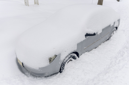
This weather disturbance follows a previous storm that deposited significant snow and freezing rain from Kentucky to Washington, D.C., resulting in numerous traffic accidents, power outages, and threats of floodwaters. The storm stretched from Kentucky through Maryland and sparked extensive snowfall, with locations like Iron Gate, Virginia, receiving over 14 inches of snow and White Sulphur Springs, West Virginia, recording 12 inches.
As of Thursday morning, over 190,000 customers in Virginia and upwards of 16,000 in North Carolina remained without power. Appalachian Power, serving one million customers in West Virginia, Virginia, and Tennessee, had over 5,700 workers dedicated to restoring electricity.
The storm caused delays and cancellations across nearly 3,500 flights at U.S. airports, as reported by FlightAware.com.
In a separate incident in Mississippi, a suspected tornado generated debris in Columbia, where it tore off the steel roof of a factory and damaged around 20 homes, according to video footage. Fortunately, there were no fatalities or severe injuries reported, as stated by Columbia Mayor Justin McKenzie.
In Kentucky, wintry roads resulted in a fatal head-on collision in Nelson County, where a driver lost control and collided with an oncoming truck. The incident left the driver deceased at the scene.
In Virginia, where the governor has declared a state of emergency, approximately 850 vehicle crashes were recorded by state police over the preceding days, with some involving injuries. It remains unclear how many of these accidents were directly related to the inclement weather. Maryland State Police also reported 235 crashes and multiple stranded vehicles.
Out west, the Pacific Northwest braced for freezing rain and snow, prompting concerns about potential power outages, according to the National Weather Service. In Multnomah County, Oregon, a state of emergency was extended through at least Thursday as six shelters remained open, welcoming 356 visitors on Tuesday night. Wind chill in Portland could plummet to 10 degrees Fahrenheit, further complicating matters.
Idaho is under an advisory due to severe cold conditions, with wind chills potentially reaching a frigid 13 degrees below zero in the state’s north central region. With Valentine’s Day approaching, Portland’s ice storm threats may hinder the delivery of flowers and gifts. Despite the challenges, local floral business co-owner Julia Duncan expressed optimism, recounting previous experiences with ice storms. She assured customers that preparations would be made to fulfill their holiday needs.

