Rainfall has commenced in California as an atmospheric river is predicted to unleash significant amounts of rain, strong winds, and flooding on Thursday, particularly affecting regions previously devastated by wildfires. In anticipation of the storm, local authorities have been proactive, distributing sandbags and strategically positioning rescue swimmers while advising residents to prepare their emergency go-bags.
Portland, Oregon, has taken precautions by applying liquid anti-icer on its streets, and emergency shelters have been made available in both Oregon and Idaho to accommodate residents facing potential snow and ice later this Thursday.
Southern California is bracing for the storm, with mountains expected to receive up to 6 inches (approximately 15 centimeters) of rain, while coastal areas and valleys might experience around 3 inches (nearly 8 centimeters), as reported by Brent Bower, a hydrologist from the National Weather Service. The storm also carries the threat of strong wind gusts that could damage trees, disrupt power supply, and delay flights.
Evacuation alerts have been issued for several areas, including Mandeville Canyon and regions affected by the devastating Palisades Fire, due to concerns over possible debris flows triggered by the rainfall. Warnings have also been extended for Trabuco Canyon and other locales near previous wildfire burn scars.
All schools in Malibu were closed on Thursday, and the Knott’s Berry Farm amusement park also shut its doors in response to the incoming atmospheric river, which is a long stream of water vapor formed over the ocean that moves moisture from tropical regions to the northern latitudes.
Daniel Swain, a climate scientist affiliated with the University of California Agriculture and Natural Resources, articulated that while the region desperately needs rain, the intensity of this storm could lead to an excess of rainfall in a short period. This could result in dangerous debris flows and flash flooding in areas recently affected by wildfires.
Burnt landscapes face an increased risk of debris flows, as essential vegetation that stabilizes the soil has been destroyed, leading to an accumulation of loose debris like ash, soil, and rocks, according to Swain.
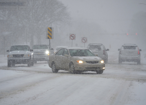
Heavy snowfall and freezing rain swept across the eastern United States, affecting areas from Kentucky to the capital, Washington D.C., resulting in hundreds of vehicular accidents, power outages, and potential flooding hazards. The storm system, which tracked from Kentucky through Maryland and further north on Tuesday, dropped more than 14 inches (37 centimeters) of snow in Iron Gate, Virginia, and 12 inches (30.5 centimeters) in White Sulphur Springs, West Virginia, as outlined by the National Weather Service.
By Thursday morning, more than 150,000 Virginia residents and over 13,000 people in North Carolina were without power, as reported by PowerOutage.us. Appalachian Power, which serves approximately one million customers across West Virginia, Virginia, and Tennessee, mobilized over 5,700 workers to restore services.
Numerous airports in the impacted region recorded several inches of snow, indicated Scott Kleebauer from the Weather Prediction Center. Wednesday witnessed a significant disruption in air travel with nearly 7,000 flights canceled or delayed throughout the United States, including almost 300 at Ronald Reagan National Airport.
In Mississippi, a suspected tornado wreaked havoc in Columbia, where it launched substantial debris into the air, damaged several homes, and tore off the steel roof of an industrial building. Fortunately, there were no fatalities or serious injuries reported, as stated by Columbia Mayor Justin McKenzie who expressed relief over the lack of serious escalation following the incident.
In Kentucky, treacherous snowy conditions led to a head-on collision on Tuesday which resulted in one fatality when a driver lost control and collided with an oncoming semi-truck, as per the county’s emergency management director. In Virginia, where a state of emergency was declared, authorities reported around 850 vehicle accidents over a two-day span, with some resulting in injuries. Maryland State Police reported 235 crashes and encountered about 185 stranded vehicles.
In southern West Virginia, multiple accidents caused significant disruptions on several major highways.
The Pacific Northwest faces its own weather challenges with forecasted freezing rain and snow potentially causing power outages in northwest Oregon and southwest Washington. The state of emergency in Multnomah County, Oregon has been prolonged through at least Thursday, with six emergency shelters available for residents. As of Tuesday night, 356 individuals had sought refuge in these shelters. Wind chill temperatures in Portland may drop to as low as 10 degrees Fahrenheit (approximately -12 Celsius).
Idaho has issued a cold weather advisory, with expected wind chills plummeting to -13 degrees Fahrenheit (-25 degrees Celsius) in the northern regions of the state.
An impending ice storm affecting the Portland area early Thursday and Friday may disrupt the delivery of flowers and gifts ahead of Valentine’s Day. Recent plummeting temperatures have created winter conditions in a region generally more accustomed to rainfall. Julia Duncan, co-owner of Flowers in Flight, displayed optimism about managing the situation, recalling how the area has survived icy weather in previous years and noting that customers are often willing to brave tough conditions for Valentine’s Day gifts.
“It’s Valentine’s Day!” Duncan emphasized. “We’ll just have to wait and see how it turns out.” She mentioned the strong community presence, with neighbors often doing pickups and having delivery drivers who are determined to travel through the challenging weather conditions.


