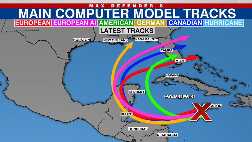
The tropics remain active as a disturbance in the Caribbean shows signs of strengthening into a tropical depression. The National Hurricane Center has indicated that this system could develop further in the coming days.
Potential path and timing of the storm

While the exact trajectory of the disturbance remains uncertain, some models suggest it could enter the Gulf of Mexico and head toward Florida. However, these long-range predictions are still too early to provide clarity, as said by Max Defender 8 Meteorologist Amanda Holly. The storm could either be swept out to sea or become a tropical storm or even a hurricane over the next week. Meteorologists are continuing to track the system closely, with a focus on determining its intensity and eventual path as it develops.
Forecasters monitor development
Currently, the disturbance has a 40% chance of becoming a tropical depression in the next 48 hours, and an 80% chance over the next seven days. If the system reaches tropical storm strength, it will be named Sara. Despite it being November, which typically marks the end of the hurricane season, the warmer waters of the Caribbean can still fuel storm development.
Historical context of November storms
November is often the time when hurricane season winds down, but history shows that storms can still form. Floridians have seen late-season hurricanes before, with five storms impacting the state after November 20th. Of those, only one reached hurricane status: Hurricane Kate in 1985. More recently, Hurricane Nicole made landfall in Florida in November 2022, underscoring the continued risk of tropical storms even as the season’s official end approaches.
Ongoing monitoring and forecast updates
As the disturbance evolves, the National Hurricane Center will continue to provide updates. Forecasters are particularly focused on the storm’s potential to strengthen and its movement within the Caribbean and Gulf regions. Given the current uncertainty in the storm’s path, residents in Florida and surrounding areas are advised to stay informed and monitor any new developments.