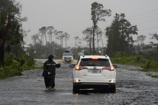
Tropical Storm Debby made landfall in Florida as a Category 1 hurricane and then weakened as it moved towards Georgia and South Carolina, posing a significant risk of heavy rain and catastrophic flooding. The Saffir-Simpson Scale, which measures hurricanes based on wind strength, may not fully depict the potential dangers of a storm, as factors like the storm’s speed, size, rainfall, storm surge, and local geography also play crucial roles in determining its impact.
The location where a storm hits and its trajectory inland are essential in assessing the risk it poses, as densely populated areas with aging infrastructure can be more vulnerable to damage. Despite Debby hitting a less populated area in Florida, cities like Savannah, Georgia, and Charleston, South Carolina, should take precautions due to their susceptibility to flooding. Weaker storms can still cause significant problems, as seen with Hurricane Beryl in Texas last month, which resulted in widespread power outages and fatalities.
Comparisons can be drawn between Tropical Storm Fay in 2008 and Debby, illustrating that a storm’s speed and duration of rainfall can be more destructive than its wind strength alone. The former director of the Federal Emergency Management Agency, Craig Fugate, advises focusing on local weather information rather than solely relying on national forecasts for more accurate assessments of a storm’s potential impact. Checking the National Weather Service’s website for localized updates and considering factors beyond flood zone maps are recommended for better preparation and understanding of a storm’s threats.


